Earthquake omen: Land around San Andreas Fault rising, sinking
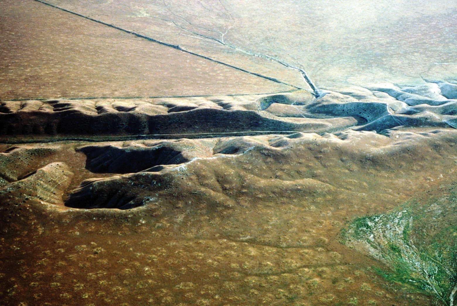 |
| Photo shows a valley eroded along the San Andreas Fault in the Carrizo Plain. The downstream segment of the channel on the west side (far side) of the fault has been displaced a kilometer or more from the upstream segment (left out of view). (USGS ) |
For the first time, a computer image shows huge sections of California rising and sinking around the San Andreas Fault from seismic strain that will be ultimately released in a large earthquake.
For the first time, scientists have produced a computer image showing huge sections of California rising and sinking around the San Andreas Fault. The vertical movement is the result of seismic strain that will be ultimately released in a large earthquake.
The San Andreas Fault is California?s longest earthquake fault, and one of the state?s most dangerous. Scientists have long expected that parts of California are rising ? and other parts sinking ? around the fault in a way that is ongoing, very subtle and extremely slow.
Such vertical movement makes a lot of sense. California sits on the border of two gigantic tectonic plates ? the Pacific and North American ? that are constantly grinding past each other.
But actually observing how California?s landscape is rising and falling from seismic strain has been an elusive goal, until now.
In a study published in the journal Nature Geoscience on Monday, scientists found that much of the Los Angeles Basin, Orange County, San Diego County and the Bakersfield area are sinking 2 to 3 millimeters a year ? a couple of penny-widths annually. By contrast, Santa Barbara and San Luis Obispo counties, and a large portion of San Bernardino County, are rising at the same rate.
The areas closest to the San Andreas Fault, however, remain locked in place. When the next big earthquake strikes, the different parts of Southern California will lurch back to the same level.
?Once there is a major event, all of that energy gets released,? said Sam Howell, a doctoral candidate in geophysics at the University of Hawaii at Manoa and the lead author of the report.
Besides Howell, the other co-authors of the study were Bridget Smith-Konter and Neil Frazer, also at the University of Hawaii; Xiaopeng Tong of the University of Washington; and David Sandwell, of the Scripps Institute of Oceanography at the University of California, San Diego.
The region of the San Andreas Fault between Monterey County and Imperial County hasn?t moved in a significant way in more than 150 years, and other parts of the fault have been accumulating stress for more than 300 years.
The last big earthquake on the southern San Andreas Fault, a magnitude 7.9 temblor, ruptured from Monterey County through Los Angeles County in 1857. Further south, the section of the San Andreas between San Bernardino County and Imperial County hasn?t ruptured in a major way since about 1690.
Howell said the time span for a large rupture on the southern San Andreas is, on average, once every 150 years or so. But the actual interval can vary over the centuries, and that?s why it?s hard to say exactly when the next big one will hit.
Howell said a better understanding of how California is being warped as a result of this accumulating seismic strain is helping scientists ?understand more about how the fault is behaving and the effect it?s going to have in the surrounding region.?
The study, however, isn?t expected to help scientists suddenly predict the precise time and location of the next devastating quake. ?It?s pretty much impossible to say when the next one will happen,? Howell said.
GPS data provided the raw information of how the earth is moving subtly from seismic pressure.
Howell said it has been easy for scientists to see how California was moving in north, south, east and west directions, but it was much harder to show how the state was moving vertically due to seismic forces.
The big problem was that there are other factors that can influence whether land is rising and falling, such as changing groundwater levels. Some parts of California are sinking as groundwater is pumped out for irrigation.
The breakthrough accomplished by Howell and his team involved writing a computer code that filtered out how the land was rising or falling from non-seismic factors.
?We wrote a computer code that could try and find the broad, large-scale signal,? Howell said. ?It?s trying to find the smooth trend.?
The study received funding from the National Science Foundation.
This article was originally published on by Rong-Gong Lin II. based on material provided by journal Nature Geoscience